Image
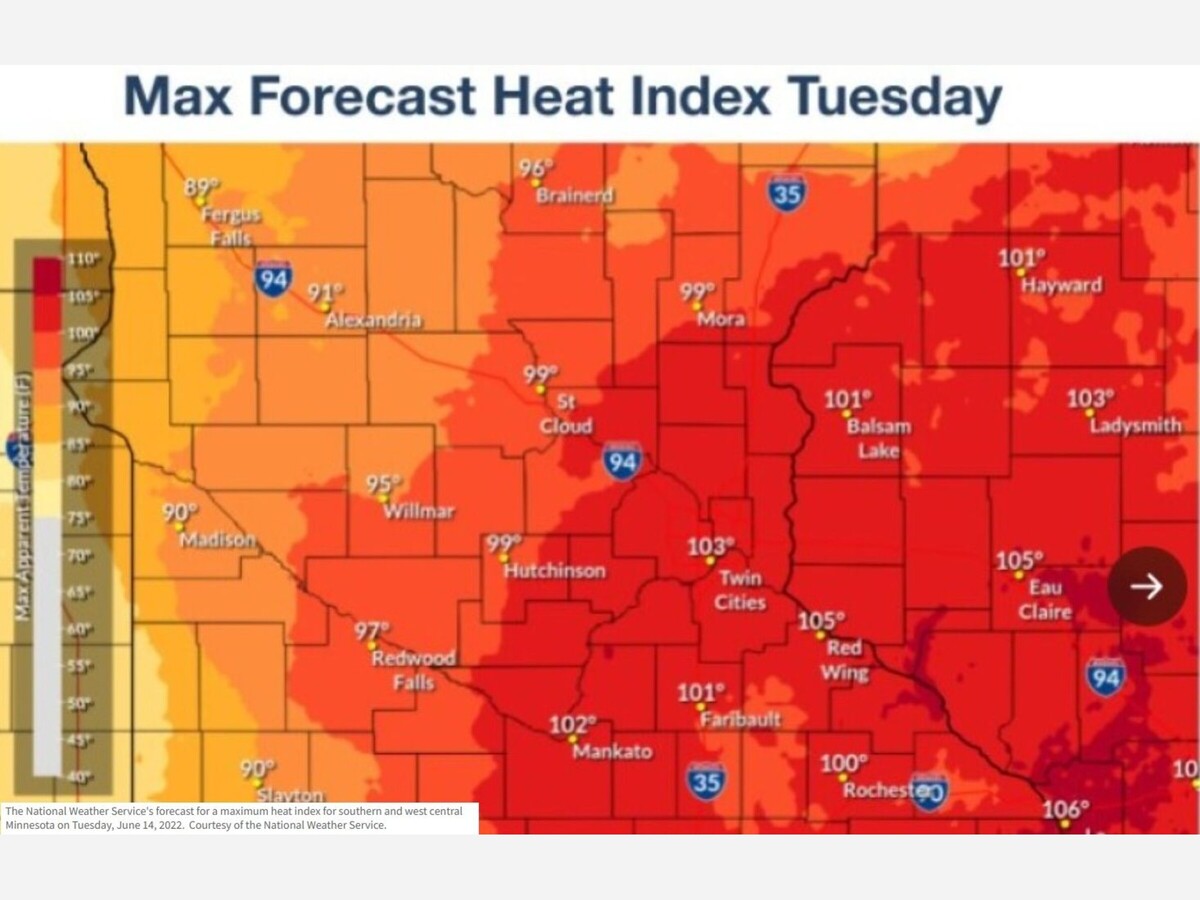

A heat advisory will be in effect for the Twin Cities on Tuesday, with storms to follow in the evening.
The advisory will be in place for Anoka, Carver, Dakota, Hennepin, Ramsey, Scott and Washington counties from noon to 8 p.m. as feels-like temps approach 100.
Courtesy: CBS Minnesota
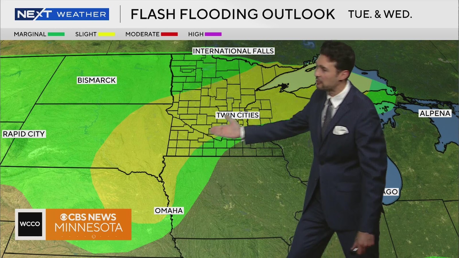
Strong to severe storms will develop up north around noon, then make their way south by evening. Hail, wind and heavy rain are all on the table as storm activity continues into early Wednesday. The metro and areas to the north could see 2 to 3 inches of rain. There is a slight risk of flash flooding.
WCCO
Cooler and drier air arrives Thursday, dropping highs to the low 70s with decreased humidity.
More storms are possible Saturday and early next week.
SOURCE: CBS News Minnesota


Thundery outbreaks in nearby, with a high of 84 and low of 63 degrees. Thundery outbreaks in nearby for the morning, partly cloudy during the afternoon and evening, clear overnight.