Image
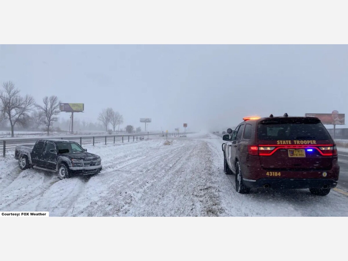

MINNEAPOLIS — A widespread winter storm is expected to sweep across southern Minnesota and western Wisconsin from Friday evening through late Saturday, complicating travel for thousands returning home after the Thanksgiving holiday. The National Weather Service (NWS) has issued a Winter Weather Advisory for the Twin Cities metropolitan area and several surrounding counties, while a Winter Storm Warning is in place for a swath of far-southern Minnesota forecast to see the heaviest snow.
Forecasters say snow will develop across the Dakotas Friday morning, pushing into southwestern Minnesota by late afternoon before spreading eastward through Saturday evening. The system is expected to deliver steady, and at times moderate, snowfall across the region for more than 24 hours.
The heaviest snow is projected along the Interstate 90 corridor, where 6 to 10 inches or more could accumulate. Counties under the Winter Storm Warning — including Blue Earth, Faribault, Freeborn, Martin, Steele, Waseca, and Watonwan — are expected to endure the worst of the system and may see travel conditions become “very difficult” or even “impossible,” according to NWS guidance.
Farther north, counties along a line from Redwood Falls to Le Sueur to Cannon Falls are likely to receive over 6 inches of snow.

The Twin Cities and immediate suburbs — Hennepin, Ramsey, Dakota, Scott, Carver, Wright, Meeker, McLeod, Kandiyohi, and Washington Counties — fall under a Winter Weather Advisory, with forecasters calling for 3 to 5 inches of accumulation.
Although lighter than areas to the south, this amount is still sufficient to create slippery roads, reduced visibility, and extended travel times throughout the day on Saturday.
Snowfall is expected to taper off late Saturday night.
The storm’s arrival coincides with one of the busiest travel weekends of the year. Officials warn that even moderate snowfall can create significant hazards — especially when road conditions rapidly deteriorate during long-duration events.
The Minnesota Department of Transportation (MnDOT) is urging motorists to check 511mn.org for real-time updates, particularly along major highways and interstates.
The I-90 corridor, a critical east–west travel artery, is expected to face the most severe conditions. Drivers are advised to reconsider or delay all nonessential travel in areas under the Winter Storm Warning.
Authorities recommend the following precautions:
This storm marks the second significant winter system to hit Minnesota in just a few days, following an earlier round of snow and ice that contributed to hundreds of crashes and spinouts statewide. With temperatures expected to remain near or below freezing, plows and road crews may face additional challenges keeping pace with accumulation.
As holiday travelers return and the snow intensifies, Minnesotans are being urged to approach the weekend with patience — and plenty of extra travel time.


Patchy rain nearby, with a high of 94 and low of 63 degrees. Sunny in the morning, patchy rain nearby in the afternoon and evening, clear overnight.