Image

Minnesota moved abruptly into midwinter conditions this weekend as a potent Arctic cold front swept across the state on Saturday, driving temperatures steadily downward and setting up one of the coldest mornings of the season early Sunday.
According to the National Weather Service, the transition was swift and pronounced, with highs reached early Saturday before temperatures began a continuous decline through the afternoon and evening as colder air poured southward behind the front.
Saturday began with relatively seasonal readings, generally in the high teens to low 20s across much of the state. That did not last.
By midday, a strong cold front triggered what meteorologists often describe as a temperature “roller coaster,” with readings falling hour by hour instead of rising.
Behind the front, winds intensified dramatically. The National Weather Service reported wind gusts between 45 and 52 miles per hour across central Minnesota and the Twin Cities metro area. In western and northern Minnesota, the combination of falling temperatures and sustained winds created near-blizzard level wind chills at times, even without significant snowfall.
By Saturday evening, much of northern Minnesota was experiencing wind chills in the teens to 20s below zero. Southern Minnesota and the Twin Cities felt wind chills dropping into the single digits below zero, making outdoor exposure increasingly hazardous.
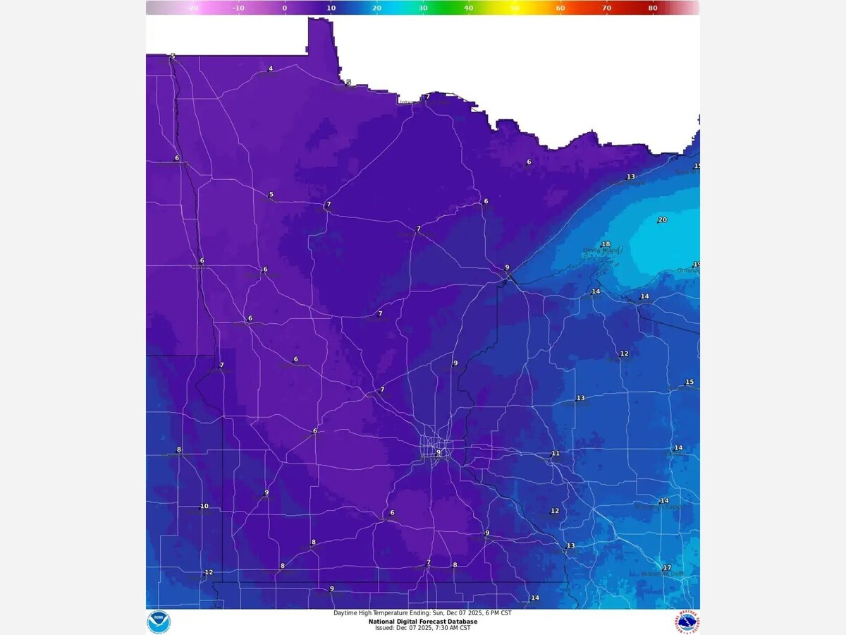
Daytime highs on Saturday varied widely by region, reflecting the timing of the frontal passage. The Twin Cities peaked near 21 degrees before temperatures fell rapidly. Moorhead struggled to reach the upper single digits, while International Falls remained near 7 degrees, reinforcing the north to south gradient of the cold air mass.
The core of the Arctic air is expected to settle over Minnesota late Saturday night, making Sunday morning the coldest stretch of the weekend.
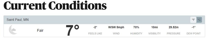
Forecasts call for overnight lows near or just below zero across much of the state, including the Twin Cities metro, where temperatures around minus 2 to minus 3 degrees are possible. Northern Minnesota will see even colder readings, with lows well below zero in some locations.
While winds are expected to ease overnight as high pressure builds directly overhead, the cold itself will remain biting through the early morning hours. Any reduction in wind will help limit the most extreme wind chills, but conditions will still feel distinctly harsh for anyone heading out early Sunday.
Sunday also coincides with the Winter Solstice, the shortest day of the year. Climatologically, this period often aligns with the arrival of the season’s first sustained Arctic intrusions, a pattern that this weekend’s forecast reflects clearly.
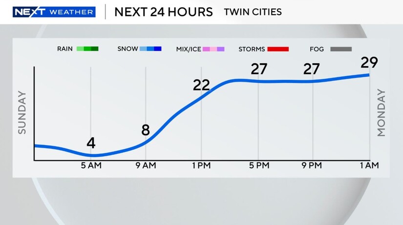
Daytime highs Sunday are expected to recover modestly, reaching the upper teens to near 20 degrees in the Twin Cities, with colder readings lingering in the north.
Despite the severity of the weekend cold, forecasters emphasize that this Arctic blast is expected to be short lived.
A noticeable warming trend is projected to begin early next week. By Monday, temperatures in southern and central Minnesota are forecast to climb back toward the freezing mark, with highs near 32 degrees in the Twin Cities and even warmer conditions farther south.
By Christmas week, some models suggest daytime highs could reach the 40s, and possibly even approach 50 degrees in parts of southern Minnesota. That would place temperatures roughly 20 degrees above seasonal averages for late December.
The immediate concern remains cold exposure and wind related hazards through Saturday night and early Sunday. In addition, forecasters are monitoring a weak disturbance expected late Sunday night into Monday morning that could bring a light wintry mix or a narrow band of snow. While accumulations appear minimal, even a light glaze or brief snowfall could create slick roads for the Monday morning commute.
Residents are advised to dress in layers, cover exposed skin, and ensure vehicles are winter ready, particularly in western and northern Minnesota where cold and wind impacts have been most intense.
The message from meteorologists is clear. Winter has arrived in full force, even if only briefly, and Minnesota will feel it most sharply as Sunday morning begins.


Patchy rain nearby, with a high of 64 and low of 53 degrees. Overcast during the morning, clear during the afternoon and evening, patchy rain nearby overnight.