Image

As Christmas 2025 approaches, the United States is experiencing a sharply divided holiday weather pattern. Much of the country is seeing an unusual late December warm-up, while pockets of the Upper Midwest, the northern tier, and the western mountains remain on track for a classic white Christmas. In Minnesota, local conditions suggest that despite mild daytime temperatures, snow cover is likely to persist into Christmas morning across much of the north metro and surrounding areas.
Meteorologists report that a strong ridge of high pressure has settled over the central and southern Plains, driving temperatures well above seasonal averages for millions of Americans. Forecasts show potential record highs on Christmas Day, with readings projected near 66 degrees in parts of South Dakota, around 77 degrees in St. Louis, and close to 80 degrees across portions of Texas and Florida.
This warm air mass is also extending northward into the Dakotas and Minnesota, raising concerns that snow received earlier in December could melt before the holiday. However, snow depth and overnight temperatures remain critical factors in determining whether a true white Christmas will be maintained.
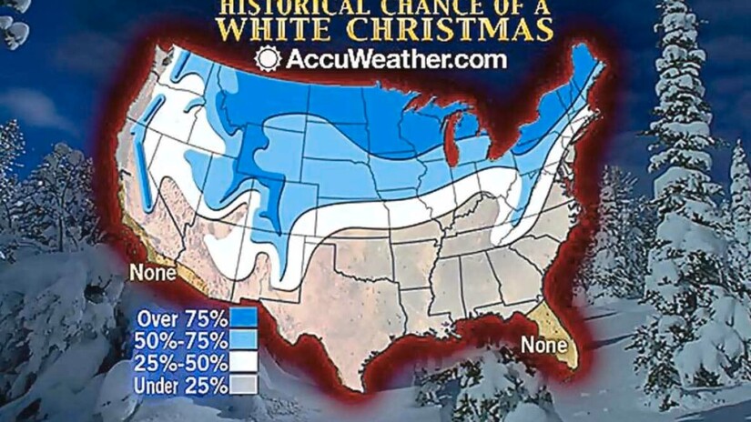
A white Christmas is commonly defined as at least one inch of snow on the ground on the morning of December 25. This benchmark is used by the National Weather Service and by state climatologists across the Upper Midwest.
In the Twin Cities region, recent snowfalls have established a base snowpack. Observations from Minneapolis St. Paul International Airport earlier this week showed measurable snow depth on the ground, providing a buffer against short-term melting even as daytime highs climb into the mid to upper 30s.
Local forecasts for Christmas Eve and Christmas Day call for mild afternoons but temperatures near freezing overnight. That pattern tends to slow snowmelt, especially in shaded areas, parks, and residential lawns. While plowed roads and sidewalks may show patchy melting, many neighborhoods are expected to wake up to snow-covered ground on Christmas morning.
The primary concern locally is not widespread melting but ice. Light drizzle or mist during overnight hours could freeze on contact, creating slick conditions on untreated roads, bridges, and walkways even where snow cover remains intact.
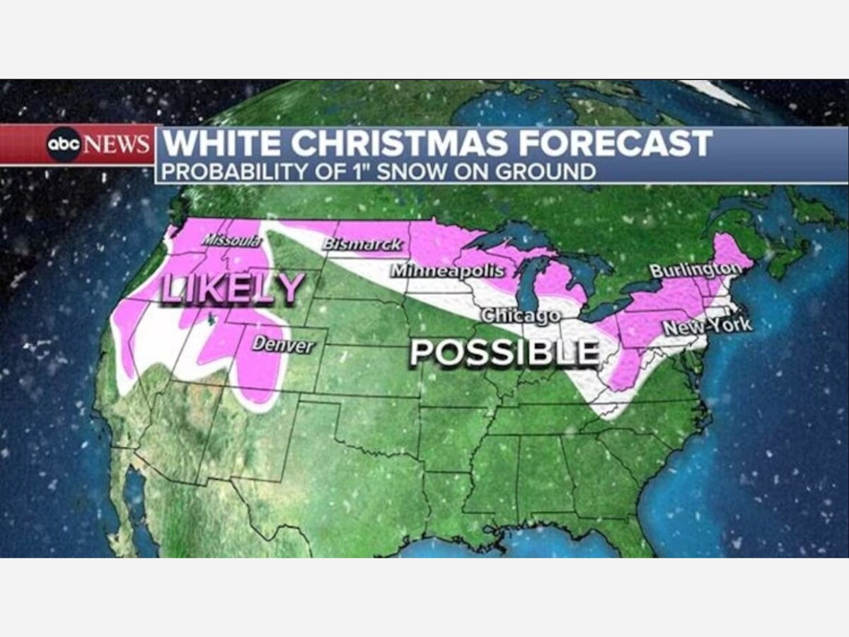
Despite the broad warm-up, several regions remain firmly on track for a white Christmas:
Forecasters are also monitoring two systems that could influence last-minute outcomes. A fast-moving storm system across the Northeast on December 23 and 24 may add one to three inches of snow in parts of New England, refreshing ground cover just in time. Meanwhile, the same Pacific pattern fueling heavy Sierra Nevada snowfall is bringing heavy rain to Southern California at lower elevations, highlighting the sharp contrasts in this year’s holiday weather.
For much of Minnesota’s north metro, including communities served by MinneapoliMedia, the forecast points to a subdued but familiar Christmas scene. Snow is expected to remain on the ground Christmas morning, even if the day itself feels more like late November than late December.
In short, while much of the nation steps into Christmas wearing short sleeves instead of winter coats, parts of Minnesota are still poised to keep the holiday tradition intact, with a white backdrop and a cautious eye on icy spots underfoot.


Sunny, with a high of 68 and low of 34 degrees. Sunny in the morning, partly cloudy during the afternoon and evening, clear overnight.