Image


The City of Coon Rapids has launched a major public engagement effort to update its Park and Recreation System Master Plan, a long range document that will guide investments, priorities, and policy decisions from 2026 through 2036. City officials are asking residents to share their ideas through an online survey and an interactive project map as Coon Rapids transitions from a decade of large scale park construction to a new phase focused on inclusion, programming, and long term sustainability.
The update follows the completion of a transformative era for the city’s park system. Between 2014 and 2024, Coon Rapids invested roughly $17.4 million, often cited as approximately $18 million in total project costs, through a voter approved park bond first authorized in 2013. That funding cycle represented one of the largest single commitments to parks and trails in the city’s history.
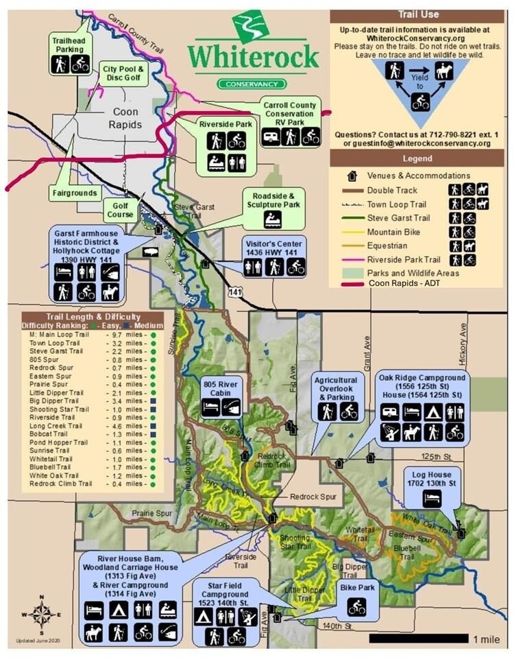
City records and prior public reports show that the bond funded sweeping improvements across the system. Eleven parks underwent full redevelopments, including major work at Lion’s Coon Creek Park and the 40 acre Sand Creek Athletic Complex, which was rebuilt to support regional level sports tournaments and large community events.
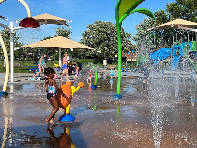
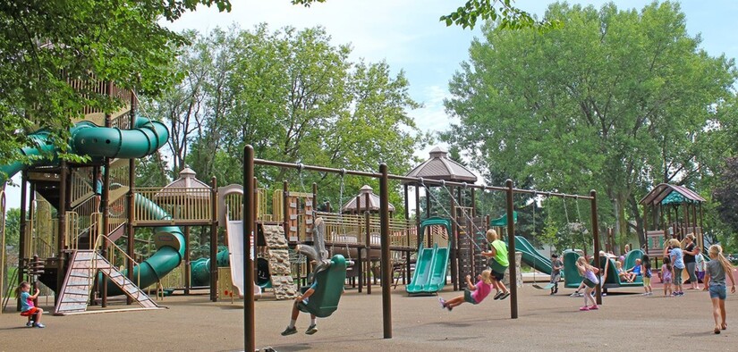
The decade also brought new amenities designed to reflect changing recreation trends. Boulevard Plaza became home to the city’s first splash pad, while dedicated pickleball courts were added at locations such as Riverwind Park. Accessibility improvements were a core focus, with the installation of ADA accessible playgrounds and rubberized safety surfacing across multiple sites. Trail connectivity projects, including the completion of the 85th Avenue Trail, strengthened links between neighborhoods and connected Coon Rapids more seamlessly to neighboring Fridley and destinations such as Springbrook Nature Center.
With most bond funded projects now complete, city leaders say the question has shifted from building new facilities to deciding how the system should evolve over the next ten years.
To guide that transition, the city has partnered with ISG Inc. to develop an updated master plan that officials describe as a roadmap for the future. The document is not a construction contract or a spending authorization. Instead, it is a strategic planning tool used to set priorities, estimate long term costs, and position the city to compete for grants or justify future budget decisions.
According to city materials, the update is centered on several key objectives. One is demographic alignment, ensuring the park and recreation system serves a growing and increasingly diverse community, including seniors, youth, and groups that have historically been underrepresented in planning processes. Another is identifying emerging recreation trends, recognizing that activities popular today may not have been on the radar a decade ago. Infrastructure sustainability is also a priority, with a focus on maintenance schedules and lifecycle planning to protect the significant public investment already made. Finally, the plan will outline potential funding strategies, which could include state or federal grants or, if voters choose, another future park bond.
The master plan update is unfolding alongside several other large scale transportation and environmental projects that intersect with parks and trails. A citywide Active Transportation Plan, supported in part by Minnesota Department of Transportation, is identifying gaps in sidewalks and trail connections to improve safety for pedestrians, cyclists, wheelchair users, and people using scooters.
At Coon Rapids Dam Regional Park, more than $2.9 million in construction is underway through 2025 to replace aging culverts and bridges near the confluence of Coon Creek and the Mississippi River. The work is intended to improve flood resilience while maintaining safe trail access. Separately, planners are advancing a proposed pedestrian bridge over Coon Rapids Boulevard, estimated at roughly $4.5 million, that would connect the Sand Creek and Coon Creek trail systems and provide a safer crossing over the six lane arterial roadway.
City staff note that coordinating these efforts is critical, since decisions made in one plan can shape outcomes in another.
Officials emphasize that public input will directly influence which projects rise to the top of the final ten year plan. Residents are encouraged to participate in two primary ways. The first is a brief online survey designed to capture general priorities and values. The second is an interactive Social Pinpoint project map where users can drop location specific comments, such as suggesting new benches, identifying areas that need better lighting, or highlighting trail safety concerns.
Engagement is currently underway, with draft recommendations expected to be reviewed by the City Council in 2025. The finalized master plan is scheduled to take effect in 2026, shaping park and recreation decisions through 2036.
City leaders frame the effort as a chance for residents to help determine how Coon Rapids builds on the legacy of the last decade while ensuring that its parks and trails continue to reflect the needs, interests, and diversity of the community in the years ahead.


Patchy rain nearby, with a high of 94 and low of 63 degrees. Sunny in the morning, patchy rain nearby in the afternoon and evening, clear overnight.