Image
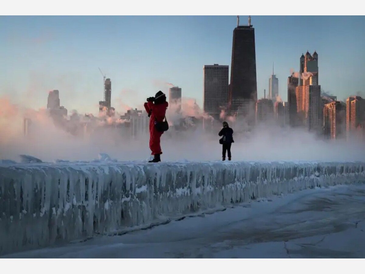

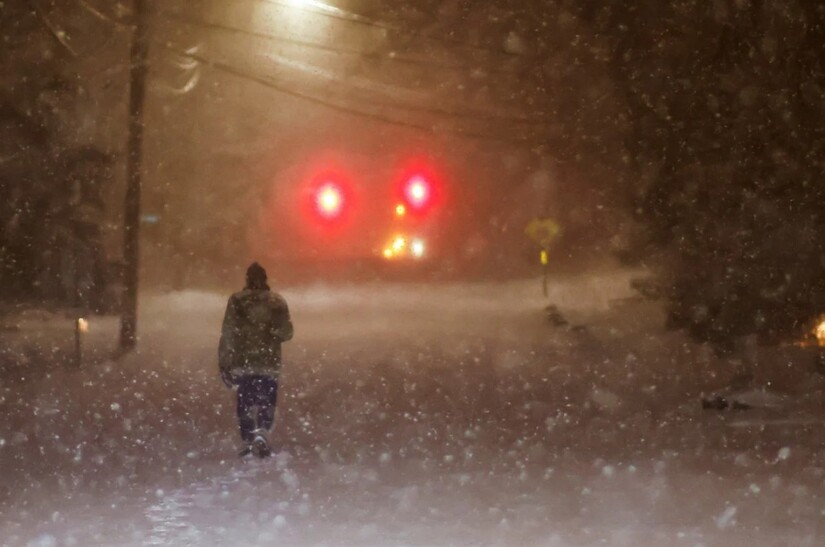
A dangerous Arctic outbreak is tightening its grip across Minnesota and the Upper Midwest as January 2026 draws to a close, transforming an ordinary winter pattern into a high-risk weather emergency. Meteorologists say the unfolding event bears the hallmarks of a classic but unusually intense polar intrusion: snow first, then a precipitous fall into deep, punishing cold that can overwhelm both people and infrastructure.
The shift is being driven by a disruption high in the atmosphere, where a buckle in the stratospheric polar vortex has allowed a lobe of Arctic air to break free and surge southward into the mid-latitudes. The result is a “one-two punch” that begins with snowfall and ends with temperatures and wind chills that can turn minutes outdoors into a medical emergency.
Forecasters are tracking this outbreak to a strongly negative phase of the Arctic Oscillation (-AO), a large-scale climate pattern that weakens the usual west-to-east flow of the jet stream. When that happens, the jet stream becomes wavier, opening a direct pathway for frigid air from the Arctic Ocean and Hudson Bay region to spill into central Canada and the United States.
“This is the kind of pattern that delivers true Arctic air,” meteorologists note, one that does not moderate quickly and can linger for days.
Across the Great Lakes and Upper Midwest, initial storm systems are delivering light to moderate snow, generally in the 2 to 5 inch range, before the coldest air settles in. In Minnesota, this snowfall is less notable for its accumulation than for what follows it.
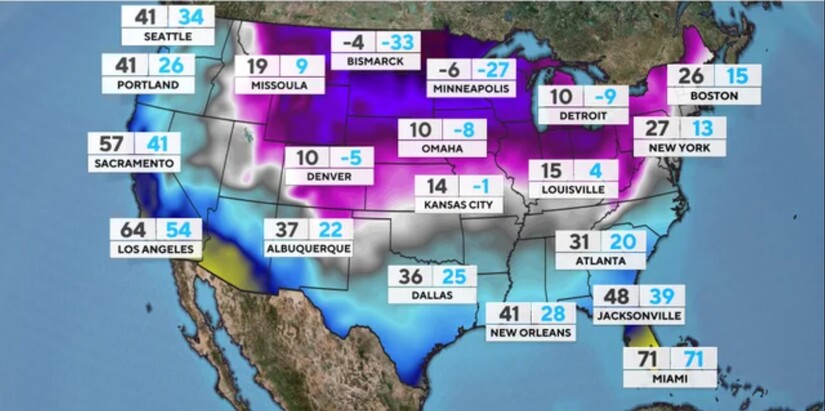
Once skies partially clear and winds increase, temperatures are forecast to plunge well below zero. In parts of Saskatchewan and Manitoba, readings of -30°F to -40°F are expected, with northern Minnesota not far behind. Farther south, including the Twin Cities, overnight lows are projected to fall into the teens and twenties below zero, even before wind is factored in.
When strong winds accompany such cold air, the effect on exposed skin can be brutal. According to the National Weather Service, wind chill values in parts of northern Minnesota are forecast to drop into the -40s and -50s, levels at which frostbite can occur rapidly. In the most exposed areas of the northern Plains and central Canada, wind chills approaching -60°F are possible, a threshold considered life-threatening.
Wind chill is not the actual air temperature. It is a measure of how quickly the body loses heat under cold, windy conditions, and it is used specifically to assess the risk of frostbite and hypothermia.
At wind chills near -60°F, the human body has almost no margin for error:
Medical experts emphasize that alcohol, fatigue, and wet clothing dramatically increase these risks.
Authorities across Minnesota are urging residents to approach this outbreak as a short-term emergency rather than a routine winter inconvenience.
Protecting homes and infrastructure
Personal safety outdoors
Travel and vehicles
Local governments and nonprofit organizations are expanding warming options as temperatures fall. In the Twin Cities, residents can contact the Hennepin County Shelter Hotline (612-204-8200) for information on emergency shelter and warming spaces. Anyone in immediate danger from the cold should call 911.
Neighbors are also urged to check on older adults, people with disabilities, and those who may be struggling with heating costs.
Animal welfare experts repeat a simple rule: if it’s too cold for you, it’s too cold for them. Short-haired pets should be outdoors only briefly, and livestock require extra bedding, windbreaks, and access to unfrozen water to survive wind chills of this magnitude.
Minnesota winters are known for their severity, but events like this one sit at the far edge of what even seasoned residents can tolerate. With the Arctic air now pouring south and little immediate relief in sight, officials stress that preparation, caution, and community awareness are the best defenses against a cold that does not forgive mistakes.


Overcast, with a high of 50 and low of 31 degrees. Sunny during the morning, overcast for the afternoon, partly cloudy for the evening, clear overnight.