Image

CHAMPLIN, Minn. (Jan. 23, 2026)
A historic Arctic air mass has tightened its grip on Champlin, Coon Rapids, and the broader Twin Cities metro, driving temperatures and wind chills into life-threatening territory and prompting widespread school closures and safety advisories across central Minnesota.
The National Weather Service Twin Cities/Chanhassen office has issued an Extreme Cold Warning for much of the region, including Anoka and Hennepin counties, in effect from 6 p.m. Thursday through noon Friday, followed immediately by a Cold Weather Advisory lasting from noon Friday through midnight Friday night.
Forecasters warn that wind chills could reach as low as -45°F, conditions that can cause frostbite on exposed skin in as little as 10 minutes.
Meteorologists describe the current outbreak as the coldest Arctic intrusion to impact the Twin Cities since January 2019, when a polar vortex event brought similarly dangerous cold across the Upper Midwest.
According to the National Weather Service, the extreme cold event will unfold in two distinct phases:
The advisory area spans central, east central, and west central Minnesota, as well as portions of northwest and west central Wisconsin, affecting major population centers including Minneapolis, St. Paul, Blaine, Elk River, and Coon Rapids.
Friday morning temperatures in Champlin and Coon Rapids are expected to bottom out near -18°F, with daytime highs struggling to rise above -6°F. Persistent northwest winds will continue to amplify the cold, keeping wind chills well below dangerous thresholds throughout the day.
While the region is not expected to surpass the all-time Twin Cities low of -34°F, set in 1936, meteorologists emphasize that the duration, geographic breadth, and wind-driven intensity of this event make it particularly hazardous.
The National Weather Service’s Hazardous Weather Outlook notes that dangerous wind chills of 40 below or colder are expected through Friday morning, with only gradual improvement into Saturday.
“This is not just an uncomfortable cold,” forecasters cautioned. “It is dangerous cold.”
In response to the warning, the Anoka-Hennepin School District canceled all classes and most activities for Friday, citing student safety at bus stops and during outdoor transitions.
District policy allows closures when wind chills approach -35°F, a threshold exceeded by a wide margin during this event.
Late activity route buses were suspended, and nearly all Community Education programs were canceled. District officials indicated that some high school activities could resume Friday evening if conditions improve.
Across Minnesota, dozens of school districts announced closures or shifted to e-learning as administrators weighed the risks posed by prolonged exposure to extreme cold.
State and local officials urged residents to stay indoors whenever possible and to take extra precautions if travel is unavoidable. Authorities recommend carrying winter survival kits in vehicles, including blankets, extra batteries, and phone chargers, as mechanical failures in extreme cold can quickly become life-threatening.
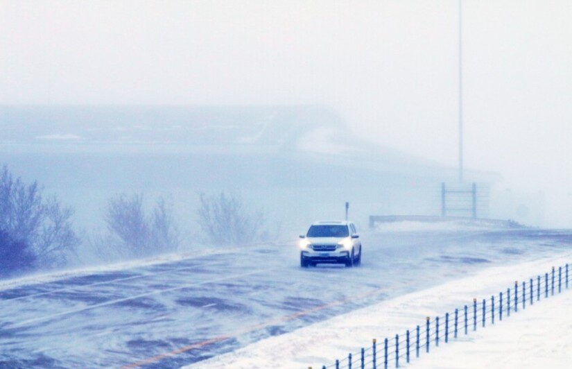
Despite generally passable roads, wind-blown snow and drifting may reduce visibility in open areas.
Forecasters described Friday’s sunshine as offering little relief. With temperatures remaining well below zero, the sun provides light but virtually no warmth.
The National Weather Service is emphasizing the following safety measures:
A slow temperature rebound is expected over the weekend. By Sunday, highs are forecast to return to the single digits, near 8°F, with continued improvement early next week. Even so, forecasters caution that lingering wind chills and the potential for light snow late Sunday into Monday could prolong hazardous conditions.
For many Minnesotans, the Arctic blast is a reminder that extreme cold remains one of the region’s most dangerous natural hazards. While rare, events of this magnitude demand vigilance, preparation, and community awareness.
Officials stress that until temperatures rise meaningfully, the cold should be treated not as an inconvenience, but as a serious public safety threat.
MinneapoliMedia will continue to monitor conditions and provide updates on weather impacts, school operations, and public safety advisories.


Sunny, with a high of 88 and low of 64 degrees. Sunny during the morning, patchy rain nearby overnight.