Image

December 27, 2025 | MINNEAPOLIS
As Minnesotans begin the slow return from holiday gatherings, a powerful winter storm is lining up to deliver one of the most disruptive weather events of the season. The system, expected to sweep across the state from Sunday into early Monday, brings with it a volatile combination of accumulating snow, strengthening winds, and sharply reduced visibility that forecasters warn could make even routine travel dangerous.
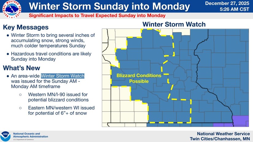
The National Weather Service has issued a Winter Storm Warning for much of east-central Minnesota, including the Twin Cities metro and north-metro communities such as Coon Rapids, Blaine, Fridley, and Anoka. The warning takes effect Sunday morning and extends into early Monday, overlapping both weekend travel and the Monday morning commute.
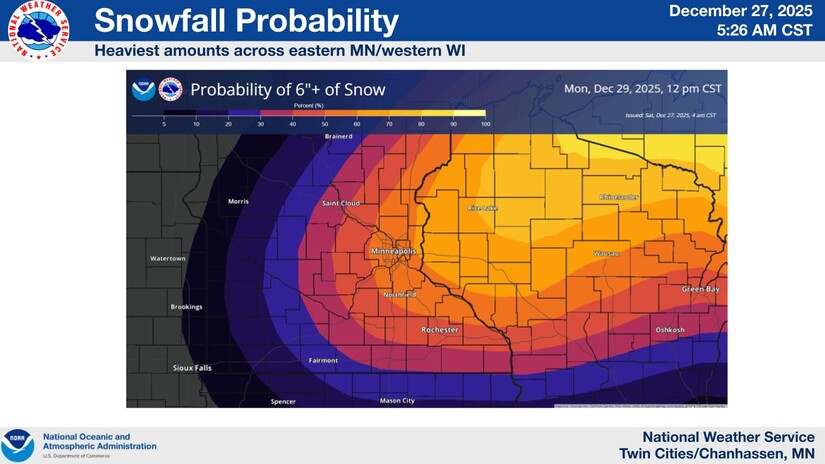
Forecasters expect several inches of snow, with totals in parts of the metro reaching five to eight inches, accompanied by strong northwest winds capable of gusting above 40 miles per hour. It is the interaction between those two forces, meteorologists emphasize, that elevates this storm from an inconvenience to a serious hazard.
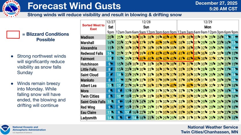
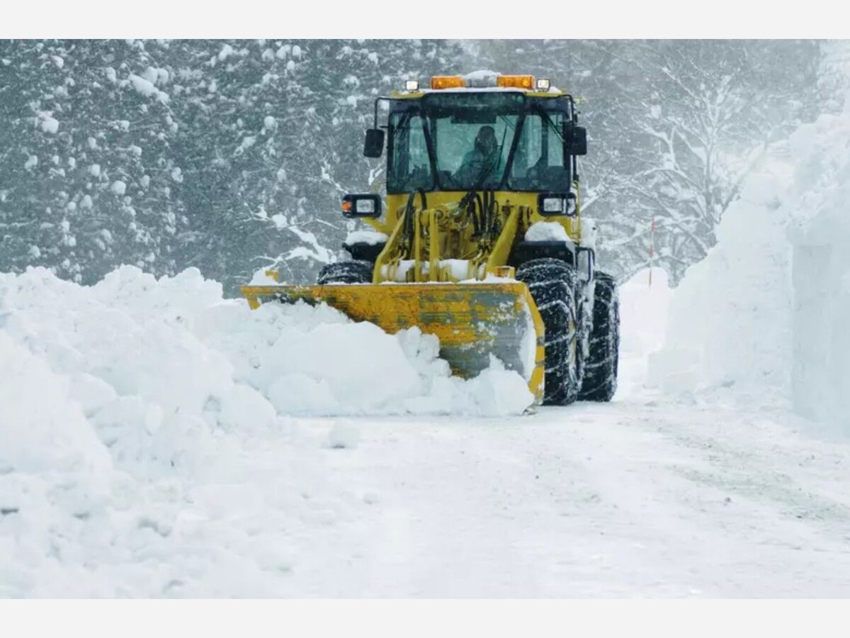
Snowfall alone rarely defines a storm’s true impact in Minnesota. In this case, freshly fallen snow is expected to be light and easily lofted by wind. As winds intensify Sunday evening and overnight, blowing and drifting snow may rapidly erase visibility on open roadways, particularly along north-south routes and rural stretches.
In practical terms, drivers could encounter moments when visibility drops to a fraction of a mile or less, with plowed roads quickly re-covered by drifting snow. These conditions are especially dangerous after dark, when visual cues disappear and reaction time shrinks.
Twin Cities and North Metro
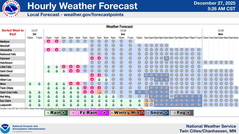
Snow is forecast to develop late Sunday morning, becoming steadier through the afternoon and evening. By Sunday night, strengthening winds are expected to produce periods of blowing snow, with the most treacherous conditions likely overnight into the Monday commute. While snowfall totals may vary neighborhood by neighborhood, travel impacts are expected to be widespread.
Central and Southern Minnesota
Farther south and west, conditions may be even more severe. Parts of central and southern Minnesota are under Blizzard Warnings, indicating a high likelihood of sustained winds and near-zero visibility. In these areas, travel may become nearly impossible for periods of time, particularly across open farmland and exposed highways.
Duluth and the I-35 Corridor
In northeastern Minnesota, including Duluth and communities along the I-35 corridor, moderate to heavy snow is expected to persist into Monday. Proximity to Lake Superior may enhance snowfall in localized areas, while gusty winds increase the risk of whiteouts along major travel routes.
The storm’s arrival late in the weekend adds to its potential impact. Many residents will be traveling home Sunday afternoon or evening, while others will face hazardous conditions during the first workday after the holiday break. Even modest snowfall rates can become dangerous when paired with strong winds and falling temperatures.
Behind the storm, colder air is expected to settle over the region, meaning untreated roads could remain slick even after snowfall tapers off.
Emergency managers and weather officials urge residents to reconsider travel plans once conditions deteriorate. For those who must be on the road, preparation is essential: checking real-time road conditions before departure, allowing extra travel time, and carrying basic emergency supplies such as blankets, water, and a charged phone.
Experience has shown that the most dangerous winter situations often unfold not during peak snowfall, but when wind, darkness, and fatigue converge. This storm carries all three elements.
Minnesota is no stranger to winter storms, and familiarity can sometimes breed complacency. But storms like this serve as reminders that even routine snow events can turn serious when wind and timing align.
As snow and wind arrive together Sunday night, the safest choice for many may be the simplest one: stay put, let road crews do their work, and allow the storm to pass. Winter will always return. How safely we move through it remains a matter of preparation and patience.


Patchy rain nearby, with a high of 94 and low of 63 degrees. Sunny in the morning, patchy rain nearby in the afternoon and evening, clear overnight.