Image
MINNEAPOLIS, MN – Residents of Minneapolis are experiencing a prolonged period of intense summer weather today, with the heat index soaring to a scorching 101°F. This oppressive heat is set to give way to a significant threat of severe thunderstorms later tonight, as warned by the National Weather Service (NWS).
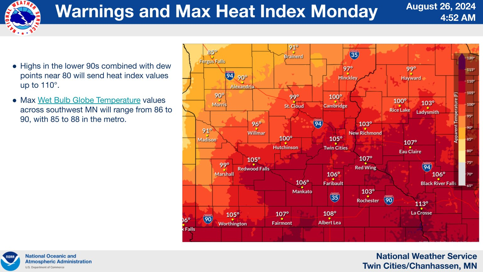
The NWS has issued an Extreme Heat Warning for the region, effective until 9:00 PM CDT tonight. Forecasts indicate actual temperatures near 92°F, but the combination of heat and humidity is pushing heat index values into the dangerous 100-105°F range across central, east-central, south-central, southwest, and west-central Minnesota. Authorities urge the public to prioritize hydration, seek air-conditioned environments, avoid prolonged sun exposure, and check on vulnerable individuals.
As the day progresses, the weather threat shifts dramatically. The NWS predicts volatile conditions overnight, with a 60% chance of precipitation and new rainfall amounts between a quarter and half an inch. The primary concerns associated with these impending storms include:
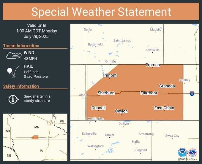
NWS Twin Cities@NWSTwinCities A special weather statement has been issued for Fairmont MN, Sherburn MN and Truman MN until 1:00 AM CDT
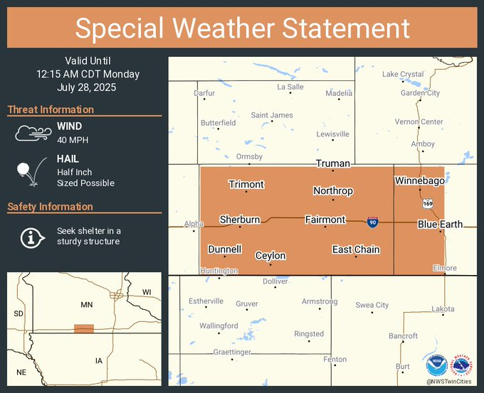
NWS Twin Cities@NWSTwinCities A special weather statement has been issued for Fairmont MN, Blue Earth MN and Winnebago MN until 12:15 AM CDT
Looking ahead, the hazardous weather pattern is expected to continue into Monday night and Tuesday, bringing the renewed threat of heavy rainfall and potential severe weather. The NWS advises that "SKYWARN spotters may be needed tonight and Monday night," underscoring the need for community vigilance and preparedness for rapidly changing conditions.
Calmer skies and a decrease in heat intensity are anticipated by midweek, with mostly sunny days forecast beginning Wednesday.
In light of these extreme weather conditions, Minneapolis citizens are strongly advised to:
The National Weather Service stresses that Warnings indicate that severe weather is imminent or occurring, requiring immediate action, while Watches signify that conditions are favorable for severe weather to develop, urging preparedness.
MinneapoliMedia will continue to provide updates as this dynamic weather situation unfolds.


Light snow, with a high of 37 and low of 30 degrees. Don't forget your umbrella! Light snow in the morning, moderate snow during the afternoon, patchy moderate snow overnight.