Image

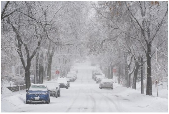
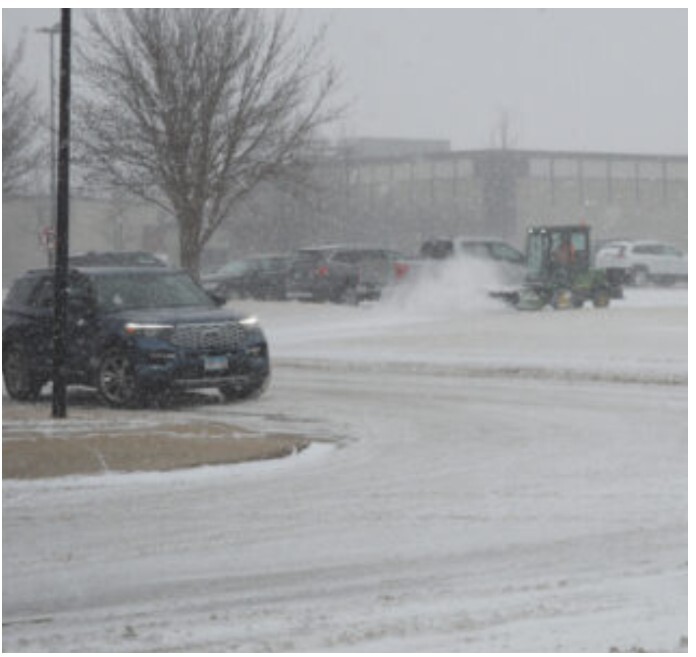
COON RAPIDS / MINNEAPOLIS, Minn. A severe surge of Arctic air has settled over the Twin Cities, locking much of the region into days of dangerous cold and reinforcing the realities of a Minnesota winter that demands preparation, caution, and community care.
According to the National Weather Service in Chanhassen, temperatures across the metro area, including Coon Rapids and Minneapolis, remain well below seasonal norms as a deep reservoir of polar air presses southward. The cold is not merely uncomfortable. It is potentially life-threatening.
Sunday brings mostly sunny skies across the northern metro, but the sunlight offers little relief. Afternoon highs are expected to struggle into the 5 to 7 degree range, while north winds of 5 to 10 miles per hour push wind chill values sharply lower.
In practical terms, this means exposed skin can become numb in minutes, and even short trips outdoors carry risk. Emergency managers continue to urge residents to minimize time outside, particularly during the coldest parts of the day.
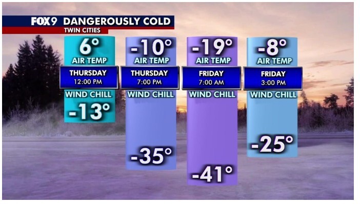
Conditions worsen after sunset. Clear skies Sunday night will allow temperatures to fall rapidly, with lows near –15 degrees in Coon Rapids and surrounding communities. Wind chills are expected to plunge further, creating conditions where frostbite can occur in as little as 10 to 30 minutes.
For residents without reliable heat, those experiencing housing instability, and older adults living alone, the overnight cold poses serious health concerns. Local service organizations and city officials are urging residents to check on neighbors and loved ones.
A subtle change in the weather pattern arrives Monday. Clouds increase, and temperatures may edge upward slightly, with highs reaching the low teens. Winds are expected to shift from the south at 5 to 15 miles per hour, offering a marginal moderation.
Monday night carries a 20 percent chance of light snow, though any accumulation is expected to be minimal. Tuesday follows a similar trend, with mostly cloudy skies and highs approaching the upper teens. Despite the slight warming, overnight lows will remain well below freezing.
Meteorologists attribute the prolonged cold to a distorted polar vortex, a large band of frigid air that has stretched unusually far south. This pattern has driven extreme cold across much of the Upper Midwest, keeping Minnesota locked in a sustained freeze rather than a brief cold snap.
Across the state, wind chill advisories and extreme cold warnings remain in effect, particularly overnight and during early morning hours.
Officials continue to emphasize basic cold-weather precautions:
In conditions like these, weather is not background information. It shapes daily life, strains resources, and tests how communities care for one another.
While a gradual easing of temperatures is possible later in the week, forecasters caution that winter remains firmly in control. For now, the Twin Cities endure — navigating frozen sidewalks, quiet streets, and the shared understanding that survival in Minnesota winter is rarely a solo act.
MinneapoliMedia will continue to monitor conditions and provide timely updates as the forecast evolves.


Patchy rain nearby, with a high of 51 and low of 46 degrees. Don't forget your umbrella! Patchy rain nearby during the morning, overcast in the afternoon, patchy rain nearby overnight.